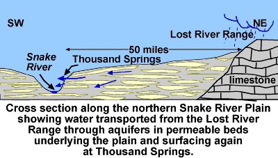
Labels:text | screenshot | font OCR: SW NE Lost River Range, Snake 50 miles Thousand Springs River limestone Cross section along the northern Snake River Plain showing water transported from the Lost River Range through aquifers in permeable beds underlying the plain and surfacing again at Thousand Springs.